Unlock the fascinating geography of Japan with an updated physical features map, revealing its dramatic mountain ranges, extensive coastlines, and active volcanic zones. This guide helps Gen Z and Millennials navigate the archipelago's unique terrain, from the iconic Mount Fuji to the deep trenches surrounding its islands. Explore how these natural elements shape Japan's culture, climate, and daily life. Discover the best digital maps to visualize elevation, river systems, and coastal plains, perfect for planning your next adventure or simply understanding this dynamic nation. Learn about the Japanese Alps, the Kanto Plain, and the numerous smaller islands, all integral to Japan's distinct physical identity. This informational resource is your go-to for trending insights into Japan's geological wonders.
- What are the primary physical features of Japan on a map? - Japan's primary physical features include extensive mountainous terrain (like the Japanese Alps and Mount Fuji), a long, irregular coastline, numerous active volcanoes, and relatively short, fast-flowing rivers. Its location on the Pacific Ring of Fire contributes to frequent seismic activity and geothermal hot springs.
- Where can I find Mount Fuji on a physical map of Japan? - Mount Fuji is prominently located on Honshu, Japan's largest island, approximately 100 kilometers southwest of Tokyo. On a physical map, its distinct conical shape and high elevation make it easily identifiable, often marked as the country's highest peak.
- How does Japan's mountainous terrain affect its climate and population distribution? - Japan's mountains create diverse microclimates and channel prevailing winds, leading to varied weather across regions. They concentrate the population into narrow coastal plains and valleys, as the majority of the land is unsuitable for large-scale development.
- Are there any major plains visible on Japan's physical features map? - Yes, the Kanto Plain, located on Honshu and home to Tokyo, is Japan's largest lowland area and crucial for agriculture and urban development. Other significant plains include the Nobi Plain (Nagoya) and the Osaka Plain, though they are generally smaller.
- What role do volcanoes play in Japan's physical landscape? - Volcanoes are integral to Japan's landscape, shaping its mountains, providing fertile soils in some regions, and fueling thousands of hot springs (onsen). Their activity is a constant reminder of Japan's dynamic geology along the Pacific Ring of Fire.
- Which are the four main islands of Japan and their relative positions? - The four main islands of Japan are Honshu (central and largest), Hokkaido (northernmost), Kyushu (southwestern), and Shikoku (south of Honshu). They form an arc, with thousands of smaller islands extending both north and south.
- How do ocean currents impact Japan's physical geography and climate? - Warm and cold ocean currents significantly influence Japan's climate. The warm Kuroshio Current brings moisture and higher temperatures to the Pacific coast, while the cold Oyashio Current affects the northern Pacific and Sea of Japan, contributing to heavy winter snows.
- What are the main mountain ranges on Japan's physical map?
- Japan's physical map prominently displays the Japanese Alps, which include the Hida, Kiso, and Akaishi Mountains in central Honshu. Other significant ranges are the Backbone Range of Tohoku and the Shikoku Mountains, all contributing to the country's rugged interior.
- Where is Mount Fuji located on a physical map of Japan?
- Mount Fuji, Japan's highest peak, is centrally located on Honshu Island. It sits southwest of Tokyo, identifiable by its iconic conical shape, marking a significant volcanic feature visible on any detailed physical map of Japan.
- What kind of coastlines does Japan have according to a physical features map?
- Japan's physical map shows a highly varied coastline, featuring jagged rias coasts with deep inlets (e.g., Sanriku Coast), sandy beaches (e.g., Pacific side of Honshu), and dramatic cliffs. The country's extensive shoreline is a direct result of its island geography.
- Are there many volcanoes shown on a physical map of Japan?
- Yes, a physical map of Japan reveals numerous volcanoes, indicating its position on the Pacific Ring of Fire. Beyond Mount Fuji, notable active volcanic zones include Hokkaido, Kyushu (e.g., Mount Aso), and the Izu Islands, often marked with specific symbols.
- How do rivers flow across Japan's main islands on a physical map?
- Japan's rivers are typically short and steep due to the mountainous terrain, flowing rapidly from interior ranges towards the coast. Major rivers like the Shinano, Tone, and Ishikari are identifiable on a physical map, often draining into coastal plains.
- What's the elevation like across Japan as depicted on a physical map?
- A physical map of Japan illustrates significant elevation changes, with high mountain ranges dominating the interior (averaging over 1,500 meters) and narrow coastal plains at much lower elevations. Color coding often represents these dramatic topographical shifts.
- Which island has the most prominent physical features according to a physical map of Japan?
- Honshu, Japan's largest island, displays the most prominent and diverse physical features, including the highest mountains (Mount Fuji, Japanese Alps), major plains (Kanto), and extensive coastlines. Hokkaido also features significant volcanic and mountainous terrain.
- Mount Fuji: Honshu Island, Shizuoka/Yamanashi Prefectures
- Japanese Alps: Central Honshu, Gifu/Nagano/Toyama Prefectures
- Kanto Plain: Eastern Honshu, Tokyo/Chiba/Kanagawa/Saitama Prefectures
- Mount Aso: Kyushu Island, Kumamoto Prefecture
- Ryukyu Islands: Southwestern Japan, Okinawa Prefecture
- Shikoku Mountains: Shikoku Island, Central Region
Ever wondered what makes Japan's landscape so unique? It's a land of striking contrasts, from towering volcanic peaks to fertile coastal plains, all shaped by its position on the Pacific Ring of Fire. Understanding Japan's physical features map isn't just for academics; it's crucial for anyone looking to explore, appreciate, or simply grasp the dynamics of this incredible nation. From the snow-capped mountains of Hokkaido to the subtropical islands of Okinawa, every inch tells a story.
Frequently Asked Questions
Where can you explore Japan's most prominent physical features?
The absolute best locations include the **Fuji-Hakone-Izu National Park** for Mount Fuji, the **Japanese Alps** spanning central Honshu, and the volcanic landscapes of **Kyushu**.
How can Local MAPs help me understand Japan's geography?
Pull up your preferred mobile Maps app to verify real-time terrain and elevation data for specific regions. Use it to visualize mountain ranges, coastal depths, and river systems, enhancing your geographical understanding and trip planning.
What are the best times to experience Japan's diverse landscapes?
Spring (March-May) offers cherry blossoms and mild hiking. Autumn (September-November) provides stunning fall foliage in mountainous areas. Summer (June-August) is ideal for Okinawa's beaches, while winter (December-February) is perfect for Hokkaido's ski resorts.
Quick Local Guide Table or Scannable List
All maps focus on Japan physical features map.
Japan physical features map highlights its mountainous terrain with over 70% covered by mountains, including the iconic Mount Fuji. Active volcanic zones are prevalent, influencing hot springs and geothermal activity. The long, irregular coastline boasts numerous bays and natural harbors. Japan is comprised of four main islands: Honshu, Hokkaido, Kyushu, and Shikoku, alongside thousands of smaller islands. The country experiences frequent seismic activity due to its location on the Pacific Ring of Fire.


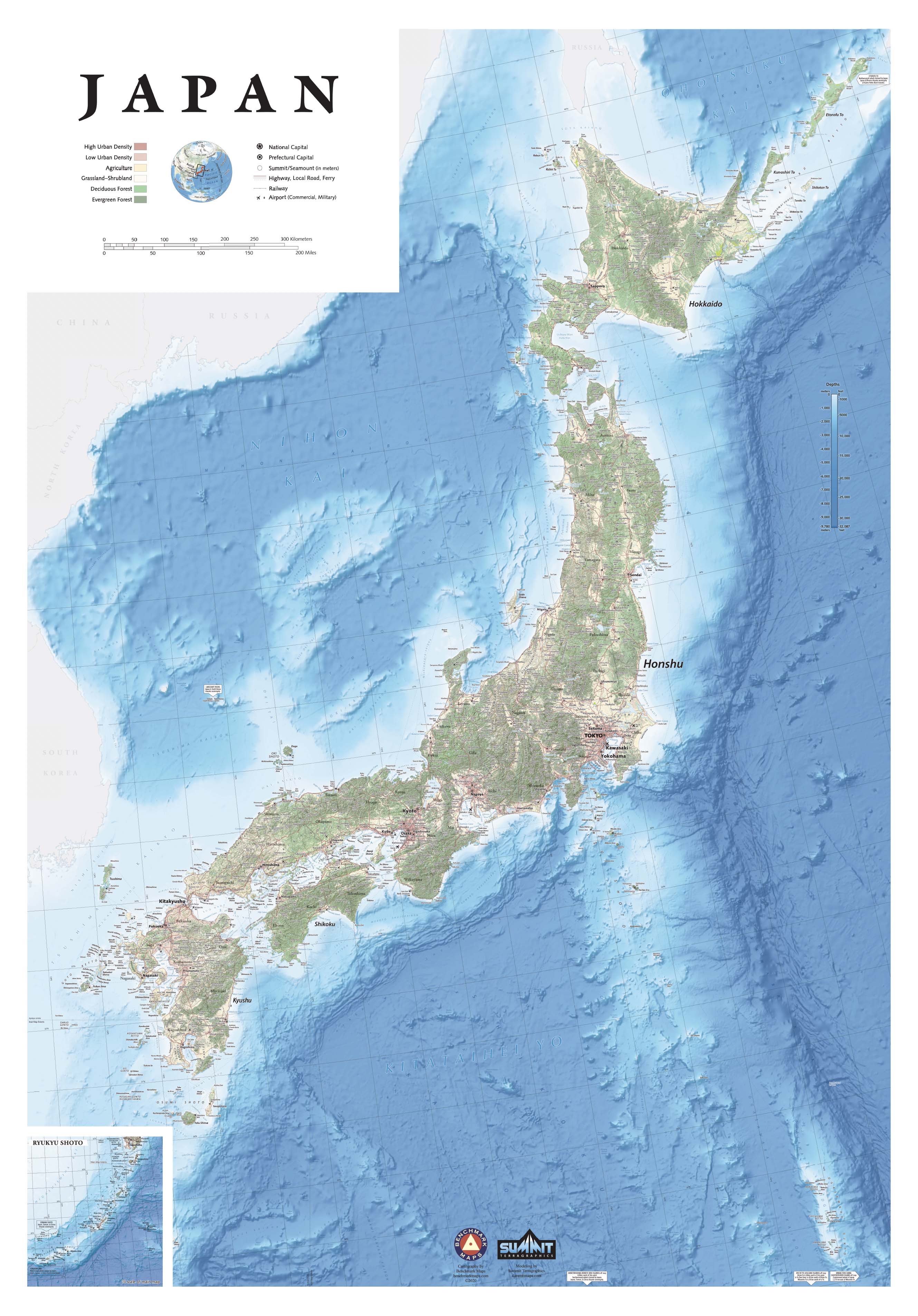
Japan Landforms Map Japan Geography Wiki Global Geography Stock Vector Japan Physical Vector Map 575953930 . Japans Physical Landscape A Deep Dive Japan Physical Map . Elevation Map Of Japan World Map With Elevation Tints Lovely Japan 3d Render Topographic Map Neutral Border Frank Ramspott . Physical Features Map Of Japan Imagesjapan Itinerary Map Japan Map Physical . Japanese Physical Features Map An Overview Of Japan S Regions With Key


Geography Of Japan Wikipedia 960px Japan Topo En . Physical Map Of Japan Physical Map Of Kanto Stock Vector Japan Physical Vector Map Colored According To Elevation With Rivers Ocean Depths And Selected 18485995 . Physical Map Of Japan Jp Physical Map Japan Lcc 72 . Exploring The Geography Of Japan A Guide JAPAN Exploring The Geography Of Japan A Guide . Physical Regions Of Japan


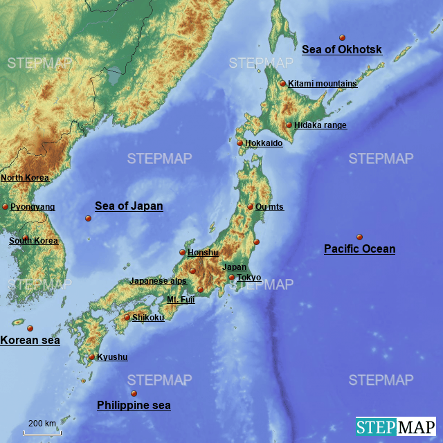

Physical Map Of Japan Physical Map Of Kanto Stock Vector Japan Physical Vector Map With Bathymetry 568322791 . Physical Geography Of Japan Lesson 1 At James Schofield Blog Highly Detailed Physical Map Of Japanin Vector Formatwith All The Relief And Big Cities 2J7GM3C . High Detailed Japan Physical Map With Labeling High Res Vector Graphic High Detailed Japan Physical Map With Labeling . Japan Physical Features Map A Physical Map Of Japan 1707636 . Large Detailed Relief Map Of Japan Japan Asia Mapsland Maps Of Large Detailed Relief Map Of Japan


What Is The Geography Of Japan Printables Templates Free Japan Physical Map . Japan Mountain Map Geographic Map Of Japan With Mountain Peaks . Japans Physical Landscape A Deep Dive . Physical Features Map Of Japan Free Printable Maps Topographic Physical Map Of Japan . Japan Physical Map From 2 5 Japan Japanmap Physicalmap 8616906 Orig

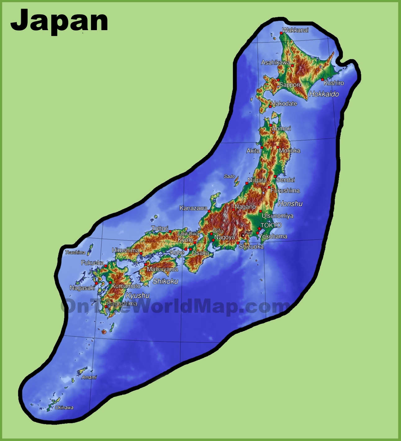


Japan Physical Features Map Stock Vector High Detailed Japan Physical Map 464775164 . Japans Physical Landscape A Deep Dive Japan Physical Map . Japan Physical Map Japan Geography . Exploring Japan An Awesome Geography Adventure Large Detailed Elevation Map Of Japan With Roads Cities And Airports . Physical Features Map Of Japan Imagesjapan Itinerary Map


Japanese Physical Fitness Lesson 2 Japan Physical Features And Climate 25 728 . Japanese Physical Map Close Up Aphysical Map Centered Japan Area Physical 283712899 . Japanese Physical Fitness Lesson 2 Japan Physical Features And Climate 2 728 . Physical Geography Of Kyoto Japan At Mae Burley Blog . Phsical Map Of Japan Physical Features Map Of Japan


Physical Map Of Japan Physical Map Of Kanto Japan Physical Map Highlighted Red D Elements Image Furnished Nasa 91852330 . PPT WORLD HISTORY PowerPoint Free Download ID 2154882 Japan Physical L . Lesson 2 Japan Physical Features And Climate PPTX Lesson 2 Japan Physical Features And Climate 1 2048 . Describe The Physical Geography Of Japan At Thomas Meng Blog 70e6U2Oq9R . Japan Map Explore The Islands Map Of Japan With