Unlocking the world through maps just got easier for Gen Z and Millennials. Dive into our ultimate guide to the Map Of Standard Geographical Terms, designed for the mobile-first generation. Discover how to instantly identify landforms, water bodies, and human-made features, transforming your digital map experience. Whether you're planning an epic road trip, exploring new hiking trails, or simply understanding global events, mastering geographical terms is key. This informational deep dive helps you navigate complex terrain data with ease, making every zoom and pan more insightful. Learn the language of the Earth as presented on your screen, from continents to coves, ensuring you're always oriented and informed. Get ready to enhance your mapping prowess and become a true digital explorer, effortlessly interpreting every geographical detail.
- What are standard geographical terms found on maps? - Standard geographical terms describe natural and human-made features like continents, oceans, mountains, rivers, valleys, islands, and cities. These terms help categorize and understand the Earth's diverse landscapes when viewing them on any map, digital or physical.
- How do I easily identify landforms on a digital map? - Look for distinct shapes and elevation changes. Mountains appear as rugged, high-relief areas; valleys are low areas between them, often with rivers. Plateaus are elevated flat lands, while plains are extensive flat lowlands. Use satellite view for realistic visualization.
- What is the difference between a strait and an isthmus? - A strait is a narrow body of water connecting two larger bodies of water, like the Strait of Gibraltar. An isthmus is a narrow strip of land connecting two larger landmasses, surrounded by water on two sides, such as the Isthmus of Panama.
- Where can I find a comprehensive list of map terminology for students? - Online resources like National Geographic's education section, university geography departments, or specialized cartography websites offer comprehensive lists. Many provide visual examples and interactive maps, making learning accessible and engaging for students of all ages.
- How do digital maps use symbols to represent geographical features? - Digital maps use various symbols: blue lines for rivers, specific icons for mountains, green areas for forests, and shaded contours for elevation. These standardized symbols ensure consistent interpretation across different mapping platforms, aiding quick understanding of complex terrain.
- What are key human-made geographical features displayed on maps? - Key human-made features include cities and towns (represented by dots or shaded areas), roads (lines), bridges, dams, and political boundaries (dashed or colored lines). These elements show human impact and infrastructure, crucial for navigation and urban planning.
- How can understanding geographical terms improve travel planning? - Knowing terms like 'archipelago' or 'fjord' helps you visualize terrain, anticipate travel challenges, and discover unique destinations. It allows for better route planning, understanding local weather patterns, and appreciating the natural beauty of an area more deeply.
What is the easiest way to identify a 'peninsula' on an HD map image?
Look for land masses significantly surrounded by water, connected to a mainland by a narrow strip. Often, they have distinct coastlines jutting into oceans or large lakes, easily visible on satellite views.
How do HD maps differentiate between a 'river' and a 'stream' using standard geographical terms?
While both are flowing water bodies, HD maps typically show rivers as wider, longer, and more prominent blue lines or areas. Streams appear narrower and shorter, often as tributaries feeding into larger rivers.
Can I use HD map images to understand 'elevation' when learning geographical terms?
Absolutely. HD map images often incorporate topographic data, showing elevation through contour lines or shaded relief. Darker or more closely spaced contours usually indicate steeper inclines, helping visualize mountains and valleys.
What does 'archipelago' mean on a geographical map, and where can I find an example?
An archipelago refers to a group or chain of islands. The Hawaiian Islands or the Indonesian Archipelago are prime examples, clearly visible on global HD map views as clusters of land surrounded by water.
How can I visually distinguish a 'bay' from a 'gulf' on detailed HD map images?
Both are inlets of the sea, but gulfs are generally larger and more deeply indented than bays. On HD maps, look for the scale; a bay will appear as a smaller, often more enclosed coastal indentation compared to a sprawling gulf.
Are there specific map symbols for 'wetlands' or 'swamps' in standard geographical terms on HD maps?
While specific symbols vary, HD maps often use distinct green shading or patterns to indicate wetlands, swamps, or marshes. These areas typically appear as low-lying, often near water bodies, with unique textural representation.
How accurately do HD maps show 'deltas' and 'estuaries' when a river meets the ocean?
HD maps are highly accurate. Deltas appear as fan-shaped landforms with braided river channels where sediment deposits. Estuaries are wider, often funnel-shaped river mouths where fresh and saltwater mix, usually without extensive land build-up.
Ever gazed at a map and felt a little lost among the labels and symbols? You're not alone. For Gen Z and Millennials, who rely on their phones for everything from finding the nearest coffee shop to planning a cross-country adventure, understanding the Map Of Standard Geographical Terms is crucial. This guide cuts through the jargon, empowering you to read any map with confidence, whether it's a topographic masterpiece or your everyday digital guide.
We know you're busy and prefer direct answers. That's why we've streamlined the essentials of geographical mapping for quick, on-the-go learning. Get ready to transform your map-reading skills and truly unlock the world around you, one geographical term at a time. It's about more than just directions; it's about understanding the terrain, the climate, and the stories embedded in every landscape.
Frequently Asked Questions
Where can I find the best resources to learn map geographical terms quickly?
For quick learning, explore interactive online maps like Google Earth or National Geographic's map resources. They visually demonstrate features like mountains, rivers, and plateaus directly on their respective locations, making identification intuitive.
How do Local MAP and other Maps apps help in identifying geographical terms?
Pull up your preferred mobile Maps app to verify real-time hours or locate specific features. Use the satellite view on any Local MAP to see actual terrain, helping you connect terms like "valley" or "mesa" to their visual representations instantly. Zoom in to grasp details.
What are the best times to practice identifying geographical terms on maps?
The best times are during travel planning or while watching documentaries. These practical applications reinforce learning. Alternatively, try a quick daily challenge on your phone during your commute or coffee break to identify new features.
Quick Local Guide Table
- Term: Peninsula - Description: Land almost surrounded by water, projecting into a sea or lake.
- Term: Isthmus - Description: Narrow strip of land connecting two larger land areas across an expanse of water.
- Term: Archipelago - Description: A group or chain of islands.
- Term: Fjord - Description: Long, narrow, deep inlet of the sea between high cliffs, typically in Norway.
- Term: Delta - Description: Landform created by deposition of sediment at the mouth of a river.
- Term: Plateau - Description: Area of high ground, typically flat on top.
All maps focus on Map Of Standard Geographical Terms.
Understand essential geographical terms on maps quickly. Enhance navigation and exploration skills for digital maps. Identify landforms, water bodies, and human-made features. Improve global awareness and travel planning. Access clear, concise definitions for map interpretation.


Terms PDF 1. World Map And Year 2026 Of The World Map With The Year 1000 F 1754974276 . The Year 2026 Over Europe A Map Of Europe With The Year 2026 Overlaid 1000 F 1760968695 . 21 Years Map Based PYQs In 1 Video UPSC 2026 Special Prelims 2026 . Projection Cylindrique Carte Syst Me De Projection Mercator World Map Caitlin Dempsey .webp


Geography Map Terms At Katherine Edmunds Blog . SOS A Climate Of Uncertainty In The Face Of Risks In 2026 Sos Risque 2026 . World Map 2026 Images Free Download On Freepik Political World Map German Language Miller Projection 509477 708 . 2026 World Map With Country Names Stable Diffusion Online 13616905 6b41 48fd A090 . Madhyamik 2026 Geography Map Pointing Suggestion Your Paragraph Text


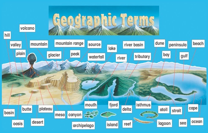


Geography 101 Key Terms And Definitions For Topographic Maps Studocu Thumb 1200 1696 . Africa Map 2026 Stock Photos Free Royalty Free Stock Photos From Global Map Showcasing Regions Number Tiles Year Global Map Showcasing Regions Number Tiles 418812709 . Geographic Terms . Geography Terms Chart School Spot Geography Terms Chart . Last Frost Date Predicted For 2026 Last Frost Date Map The Almanac Frost Date Map 2026 4


2026 World Map A Stylized World Map Video Overlaid With 1000 F 1755037871 . World Cup 2026 Geography Pack Bilingual Host Cities EN ES Map Skills . United States Midterm Election 2026 The Year 2026 IMG 4624.webp. Europe Map With 2026 Year A 3D Render Of Europe With The Year 2026 1000 F 1754972348 . Last Frost Date Predicted For 2026 Last Frost Date Map The Almanac 2026 US Spring Weather Forecast 2


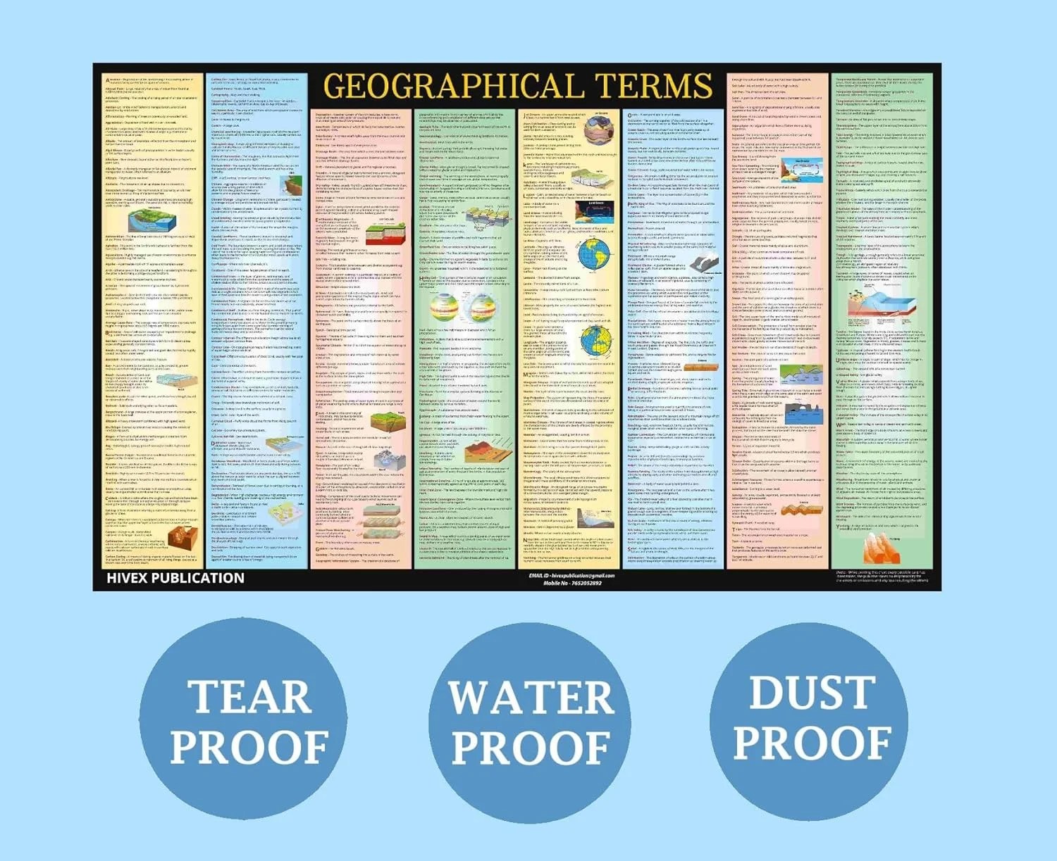
Geography Terms Chart Tools 4 Teaching Worksheets Library Terms Worksheet 15 . 184 Europe 2026 Map Stock Photos Free Royalty Free Stock Photos Future Planning Wooden Blocks Showing Map Asia Europe Concept 419099971 . World Map 2026 Defacto Borders Stock Photos Free Royalty Free Stock Wooden Blocks Displaying Year Positioned World Map Wooden Blocks Displaying Year Positioned World Map Showcasing 418434704 . Ilustrace Year 2026 On A Map A 3D Of The Year 2026 On Top Of A Map Of 1000 F 1754974380 . Terms Chart Laminated Exteremely Useful For 6 4


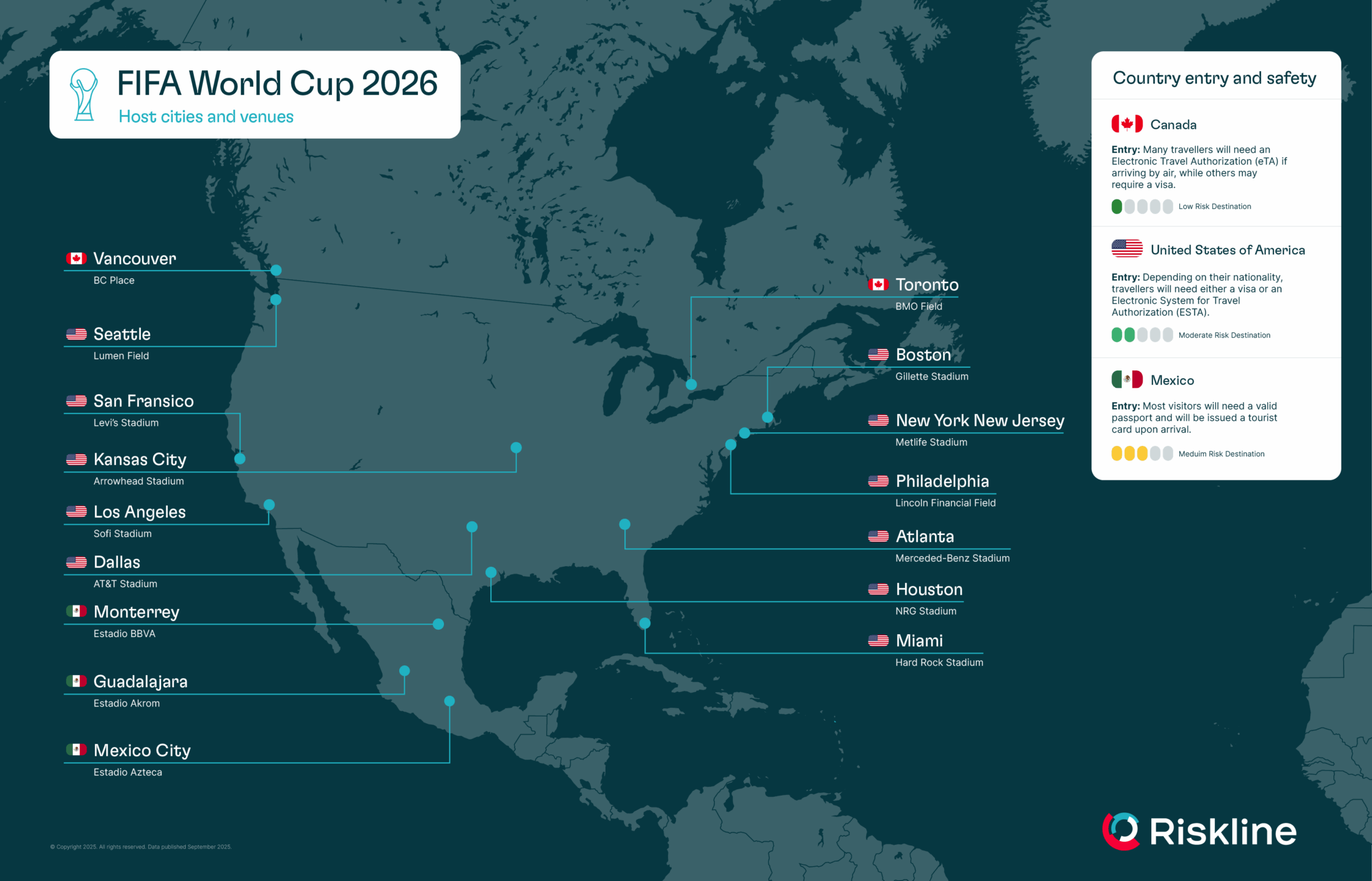
United States Map 2026 Neon A Neon Lit Map Of The United States With 1000 F 1754973883 . USA Map Of The Year 2026 A Colorful Glowing Map Of The USA With The 1000 F 1754973914 . World Cup 2026 Venues Map 6 . Superb Definitions Illustrated By Yevi Yaggy 1893 Geogr Il 8q07 . Flag Map Of The World 2026 Alternate By On DeviantArt Dg0f5c7 72556987 3fee 487a 8710


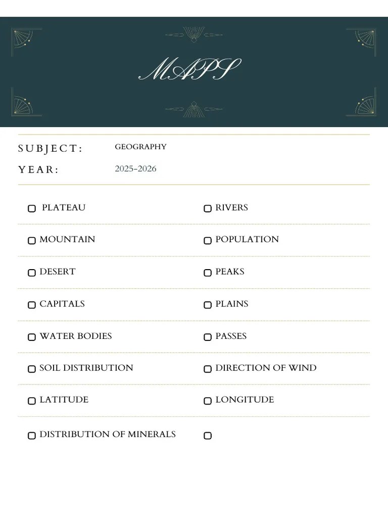
Free Printable Graph Paper Quadrant 1 Download Free Printable Graph Geography Maps 12 . EditOne Set Of 7 Wall Maps Charts India And World Combo Of 7 Geo Compressed 600x600 . Map Skills Keywords Glossary Worksheet Worksheet Worksheets Library Terms Worksheet 0 . Geography Maps For 2025 2026 PDF 1. Top Visited Countries In The World 2026 60 Foto Com World Cup 2026 Map Scaled