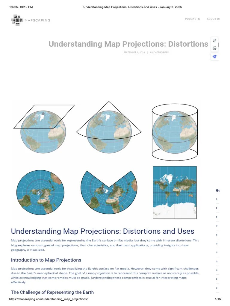
Understanding map distortions is crucial in our digitally driven world where Maps apps guide our every move. From the classic Mercator projection to modern satellite imagery every representation of our spherical Earth on a flat surface inherently involves some level of inaccuracy. This guide explores why distortions occur their impacts on navigation and perception and how various map projections attempt to minimize these visual discrepancies. For Gen Z and Millennials constantly interacting with digital Local MAP services knowing these nuances improves geographic literacy and helps interpret directions more accurately. Discover the fascinating science behind why Greenland looks so huge on some maps and how these distortions affect global understanding and local routing in 2026. This informational piece provides key insights for anyone relying on mapping technology daily.
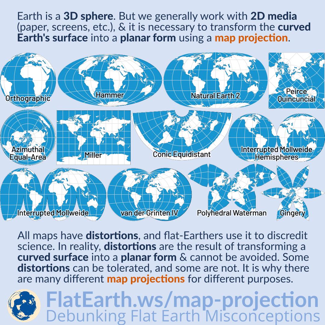
- What causes map distortions? - Map distortions fundamentally occur because it is impossible to perfectly flatten a three-dimensional sphere (Earth) onto a two-dimensional plane without stretching, compressing, or breaking features. Every map projection chooses to preserve some properties, like shape or area, at the expense of others.
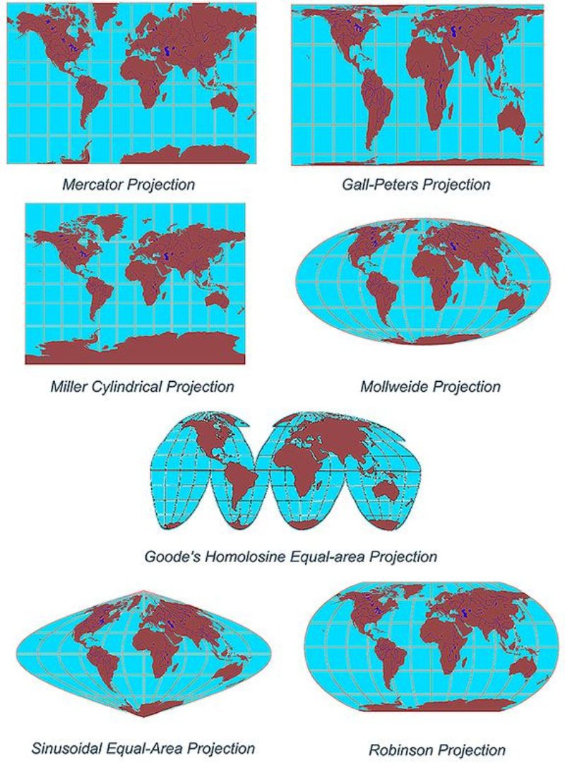
- Why does Greenland look so big on many world maps? - Greenland appears disproportionately large on many maps due to the Mercator projection. This projection significantly exaggerates the size of landmasses as they get closer to the poles. While useful for navigation due to preserving angles, it visually distorts relative areas.
- How do Local MAP applications manage distortions for accurate routing? - Local MAP applications primarily use Mercator-like projections for local navigation because they preserve angles, ensuring roads and turns appear accurate. While there's still some area distortion, it's minimized at street level, providing clear, reliable turn-by-turn directions.
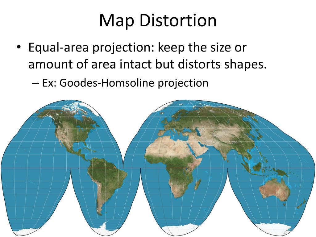
- Are there maps that show true land sizes without distortion? - Yes, equal-area projections like the Gall-Peters projection accurately depict the relative sizes of continents and countries. However, achieving true area representation often means distorting the shapes and angles of landmasses, making them appear stretched or squashed.
- What is the best map projection for a general world view? - The Winkel Tripel projection is often considered one of the best for a general world view. It seeks to minimize all three types of distortion – area, direction, and distance – striking a good balance and providing a visually appealing, less skewed global representation.
- Do digital Maps like Google Maps also have distortions? - Yes, digital Maps like Google Maps primarily use a Mercator projection at zoomed-out levels, meaning they exhibit similar distortions, especially at higher latitudes. As you zoom in, the impact of these distortions becomes less noticeable for local navigation purposes.
- Why is it important for students to learn about map projections and distortions? - Learning about map projections and distortions helps students develop critical geographic literacy. It enables them to understand that maps are interpretations, not perfect replicas, and to question how different representations can influence our perception of global relationships and inequalities.
- What are the fundamental causes of map distortions?
Map distortions arise from the inescapable challenge of projecting a three-dimensional spherical Earth onto a flat, two-dimensional surface. This process inherently requires stretching, compressing, or tearing the geographic features to fit, leading to inaccuracies in area, shape, distance, or direction.
- How does the Mercator projection distort continents, especially for Local MAP users?
The Mercator projection, commonly used in many Local MAP apps for navigation, significantly exaggerates the size of landmasses as they approach the poles. Regions like Greenland and Alaska appear much larger than they truly are, while areas near the equator are represented more accurately in relative size, preserving angles for accurate routes.
- Are there map projections that minimize area distortion for Maps users?
Yes, equal-area projections like the Gall-Peters projection prioritize preserving the true relative sizes of landmasses. While these maps accurately depict area, they often achieve this by distorting the shapes of continents, making them appear elongated or compressed, which can look unfamiliar to users accustomed to other projections.
- Why is understanding map distortions important for a Gen Z audience using digital Maps?
For Gen Z, who rely heavily on digital Maps for everything from navigation to exploring new places, understanding distortions fosters critical thinking about geographic representations. It helps them recognize that no single map is perfectly accurate and encourages a more informed interpretation of spatial data, enhancing global awareness beyond just routing.
- Do satellite images or HD aerial views also have distortions?
While satellite images capture the Earth's surface directly, they still undergo processing that can introduce minor distortions. Particularly when stitching together multiple images or adjusting for terrain, geometric corrections are applied. However, these distortions are generally far less pronounced than those from projecting a sphere onto a flat plane in traditional cartography.
- How do modern Local MAP technologies attempt to compensate for distortions in urban areas?
Modern Local MAP technologies in urban areas utilize highly localized projections and sophisticated algorithms to minimize distortions at a street level. They often switch between projections or dynamically adjust scaling as you zoom in, ensuring accurate street layouts and turn-by-turn directions within specific neighborhoods, making your navigation experience seamless.
- What is the Winkel Tripel projection, and why is it often preferred for world maps?
The Winkel Tripel projection is an azimuthal projection often considered a good compromise for world maps because it strikes a balance between minimizing area, direction, and distance distortions. It's frequently adopted by organizations like the National Geographic Society due to its visually appealing and generally more accurate global representation compared to other single projections.
Ever wondered why Greenland looks massive on some maps or why your Local MAP app sometimes shows slightly different routes? Map distortions are a fundamental aspect of cartography, stemming from the challenge of representing our three-dimensional Earth on a flat, two-dimensional surface. This inherent process means that every map sacrifices either shape, area, distance, or direction to some degree. For mobile-savvy users in 2026, understanding these distortions is key to better interpreting the information presented by your favorite Maps applications and gaining a richer geographic perspective.
Frequently Asked Questions
Where can I see the most extreme map distortions?
The most extreme distortions are often visible in polar regions on a Mercator projection, where landmasses like Greenland and Antarctica appear vastly oversized compared to their true area. Other projections like Gall-Peters correct for area but distort shapes.
How do Local Maps apps handle map distortions for navigation?
Most Local MAP services, like Google Maps, utilize a variation of the Mercator projection for local views due to its ability to preserve angles, which is crucial for navigation. While this means some area distortion exists, it ensures roads and directions appear straight and accurate. Pull up your preferred mobile Maps app to verify real-time hours, as peak weekend times fill up fast, making routing crucial.
What are the best times to consider map distortions in travel planning?
When planning international travel or educational trips focusing on geography, it's wise to consider map distortions. This applies particularly when comparing landmass sizes or understanding geopolitical boundaries. For local travel, distortions are less critical, but understanding them can enhance your appreciation of Maps technology.
Quick Guide to Understanding Projections
- Mercator Projection
- Primary Use: Marine navigation, standard Maps apps
- Gall-Peters Projection
- Primary Use: Demonstrating true land area, educational texts
- Robinson Projection
- Primary Use: General purpose world maps, balances visual appeal
All maps focus on Map Distortions
Understanding Map Distortions Essential for Digital Navigation Mercator Projection Explained Common Misconceptions About Map Sizes Impact on Local MAP Accuracy Maps Projections Explained for Everyday Users Real World Effects of Geographic Distortions Improving Geographic Literacy


Lesson Of The Day Can This New Map Fix Our Distorted Views Of The 24tb Newmap Video Image . Lab 2 Map Distortion Projection And Advantages Of Landsat ArcGIS Mercator 1024x869 . Map Distortion With Tissot S Indicatrix Tissot Robinson Projection Compromise . Magnifying Glass Digital World Map 2026 V1 Stock Adobe Stock 1000 F 1760041277 . A Bite Sized Guide To Visualising Data GOV UK 29


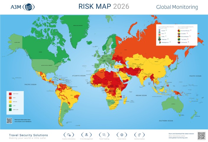


Africa S Distorted Map And The Push For Equal Earth Africa Map. The Ultimate Risk Map Of 2026 SAFETURE Riskmap 2026 EN2 1024x724 . Global Risk Map 2026 Is Onlangs Bijgewerkt VERON Risk Map 2026 . 2026 World Map A Stylized World Map Video Overlaid With 1000 F 1755037871 . Types Of Map Projections Geography Realm Tissox Matrx World Mercator Map


2026 Future Timeline On World Map Background 2026 Global Forecast And 1000 F 1872704233 . Realistic Close Up Of A Magnifying Glass Over Glowing 2026 Text On 1000 F 1673335949 . A Guide To Map Projections Geography Realm Mercator World Map Caitlin Dempsey .webp. Permanent Disruption How Politics Pollution And Power Will Define . What The Predict For Major Events In 2026 20251115 WOT900



2026 World Map Typography With Textured Continents And Oceans Ideal 1000 F 1162218985 . Princeton Re Imagine World Map Designing A Less . Reset Reshaping The 2026 Map Leonine Public Affairs Bddc9f01 Bf9a 4f9d Aac2 . 2026 Policy Priorities For Florida Web Hate Map Model . The World Ahead 2026 From The Economist 20251115 WOT911


What Is Distortion In Geography JOUAV Map . Misleading Maps And Problematic Projections 20161224 Woc932 2 . Distorted World Map Showing Future Coastlines Due To Rising Sea Levels 1000 F 1002599355 . 2026 Year Number Animation With Strong Distortions And Glitch Effects 1000 F 1768975472 . What Is Distortion In Geography New For 2026 Types Map Distortion


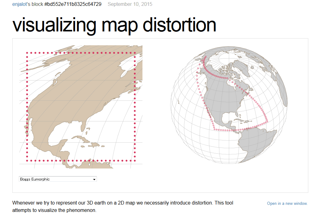
Map Projections Distortions And Uses January 6 2025 1. Why This Viral Map Is Making People Question Everything They Know About. 2026 Expansion Update Indego Blog Map 2026 Scaled . Visualizing Map Distortion That You Can Experience How Distorted By 001 . Distortion 2026 Complete Guide Stages Tips What To Expect The Distortion O 2026 Map


Explain This To Me Like I M 10 People Online Left Baffled After Guy Explain To Me Like Im 10 Map Projection Distortion Cover 675 . 35 Awesome Maps That Show The World Through History Humor And Hidden Png 700 . Explain This To Me Like I M 10 People Online Left Baffled After Guy Explain To Me Like Im 10 Map Projection Distortion 700 . Problems Of Map Projection At Zoe Bastyan Blog Map Distortion L . Spherical Map Projection Map Projections And Why They Matter One Map Projection