Understanding US time zones with a map is essential for anyone living, traveling, or conducting business across the United States. This comprehensive guide helps you easily navigate the vast country's multiple time divisions. From the Pacific to the Eastern seaboard, knowing the correct local time ensures smooth communication and avoids scheduling mishaps. We dive into the standard zones, daylight saving practices, and how a visual US time zones map can simplify your daily life. Discover the nuances that make America's timekeeping system both functional and sometimes a little tricky. Prepare to master the complexities and confidently coordinate your activities across this dynamic nation.
What are the four major time zones in the continental US?
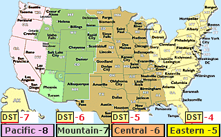
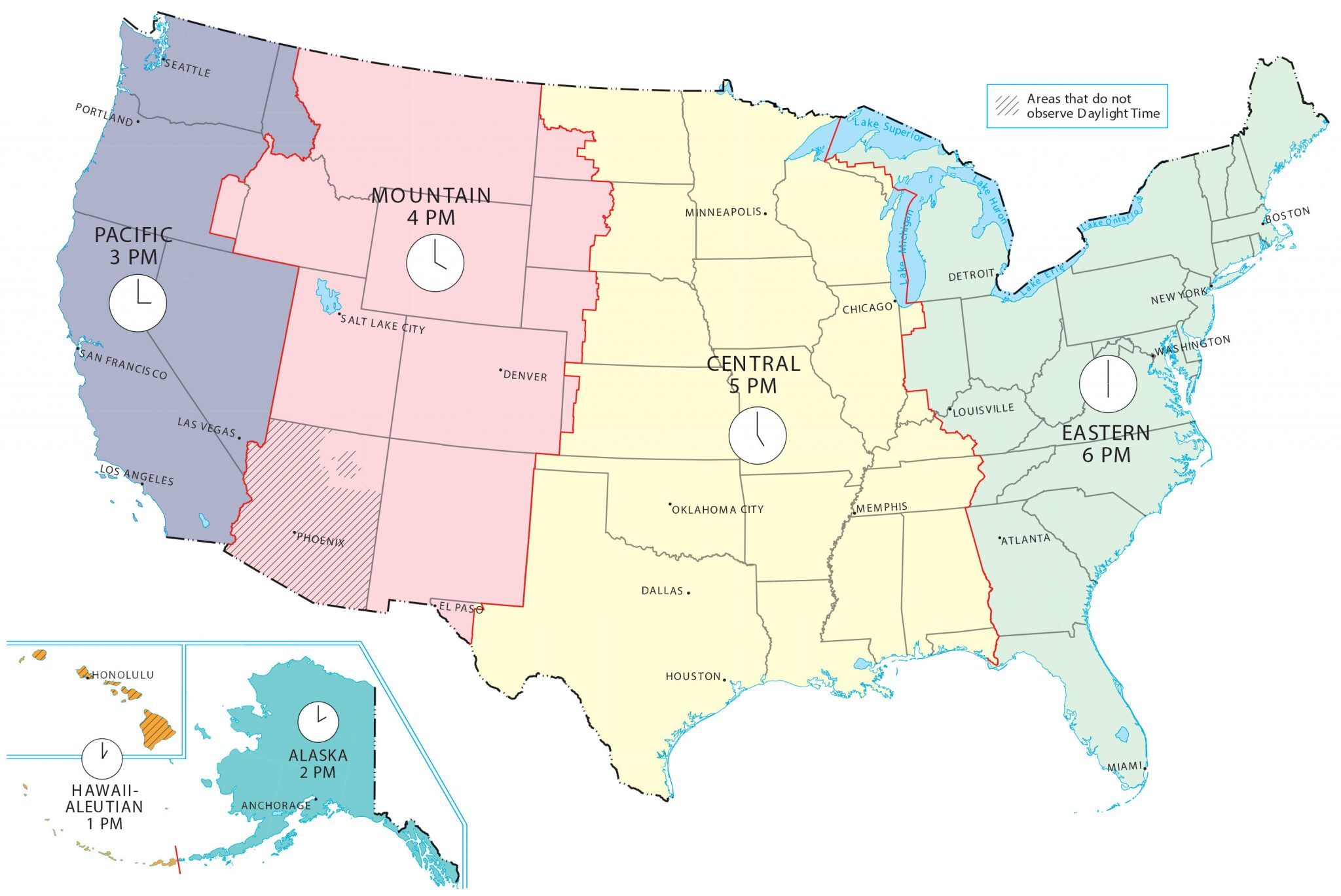
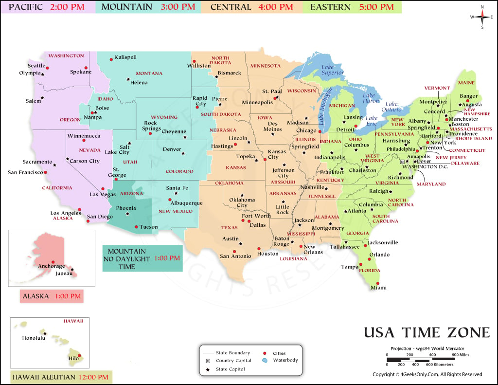
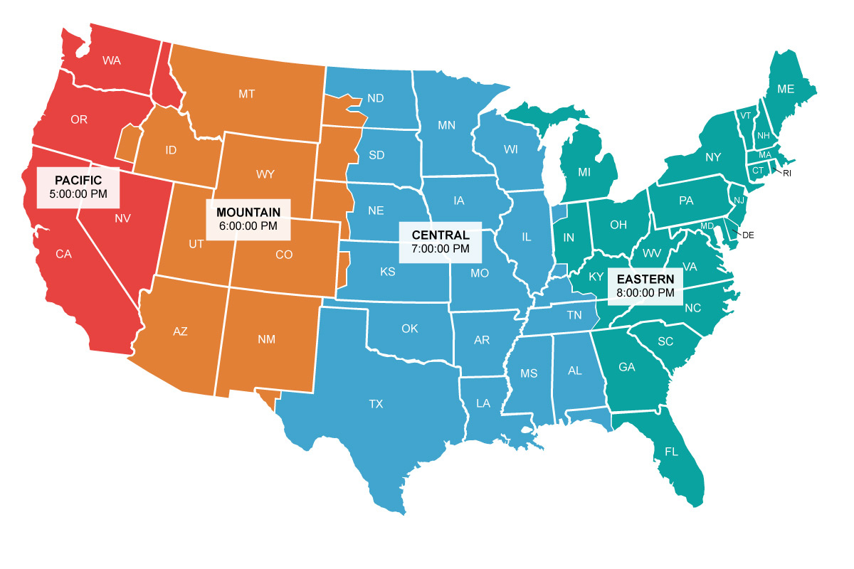
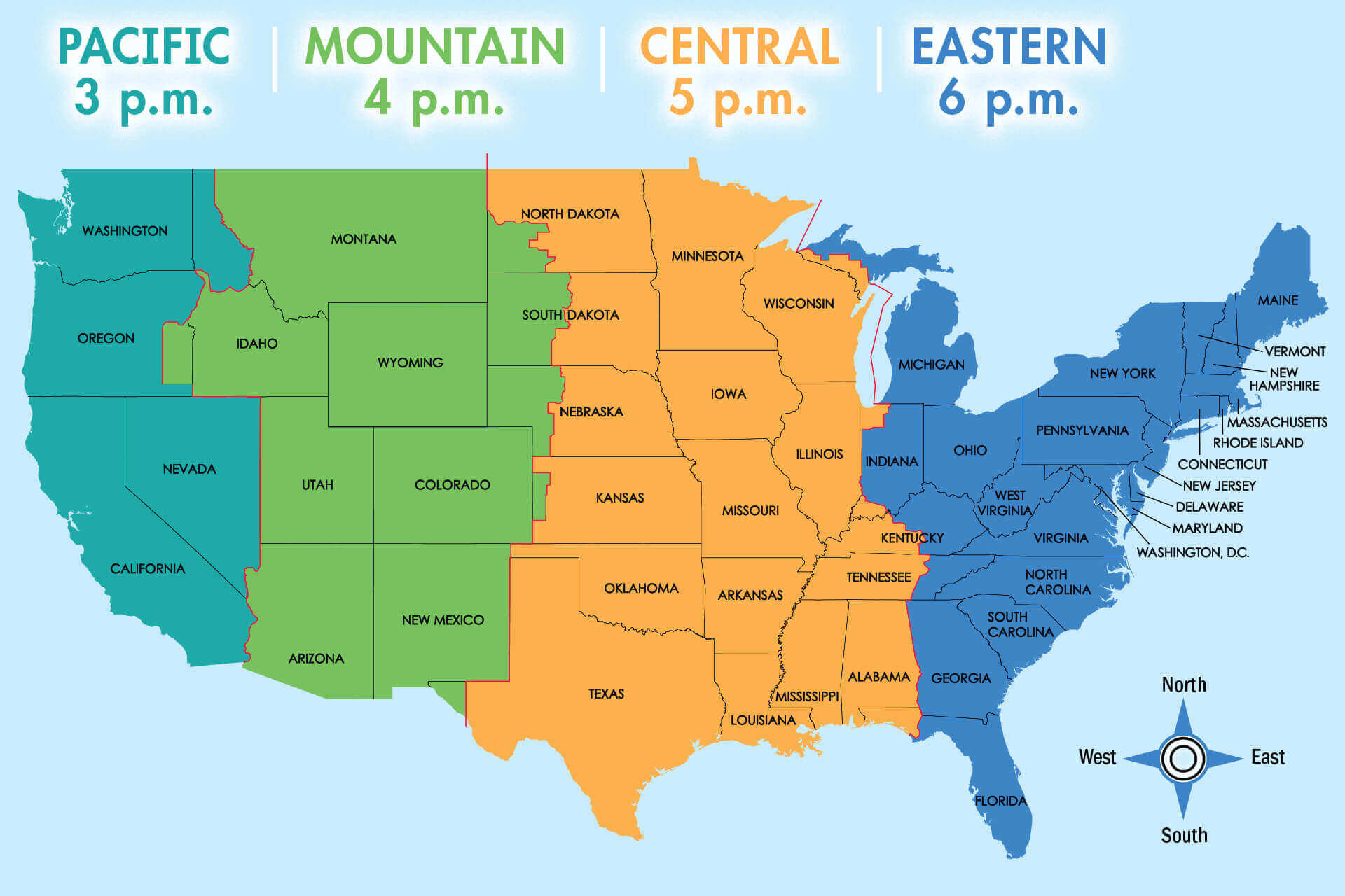
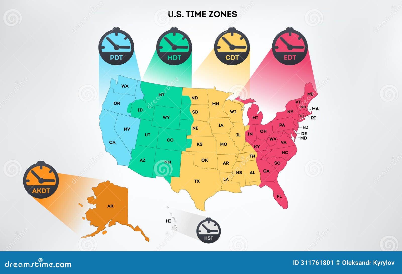
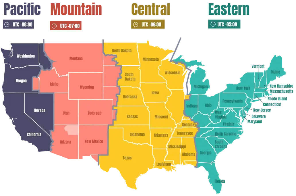
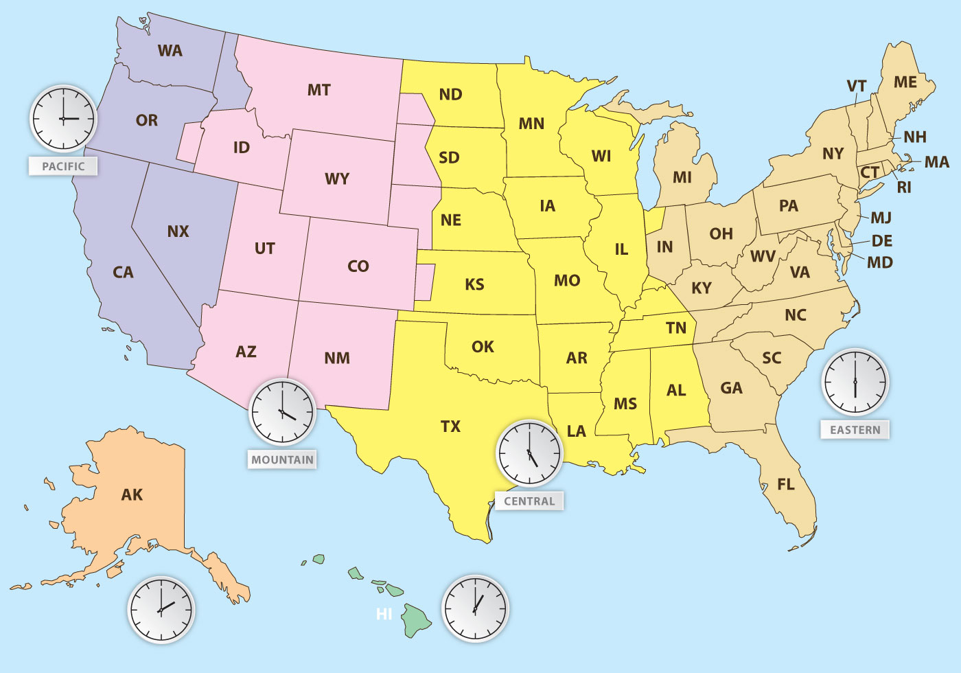
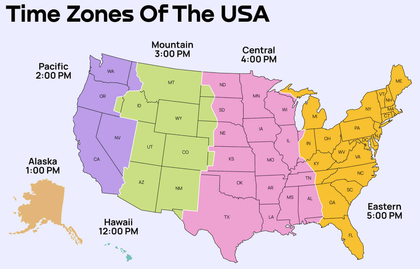
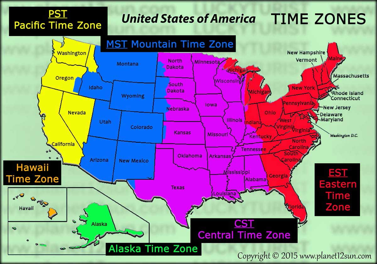
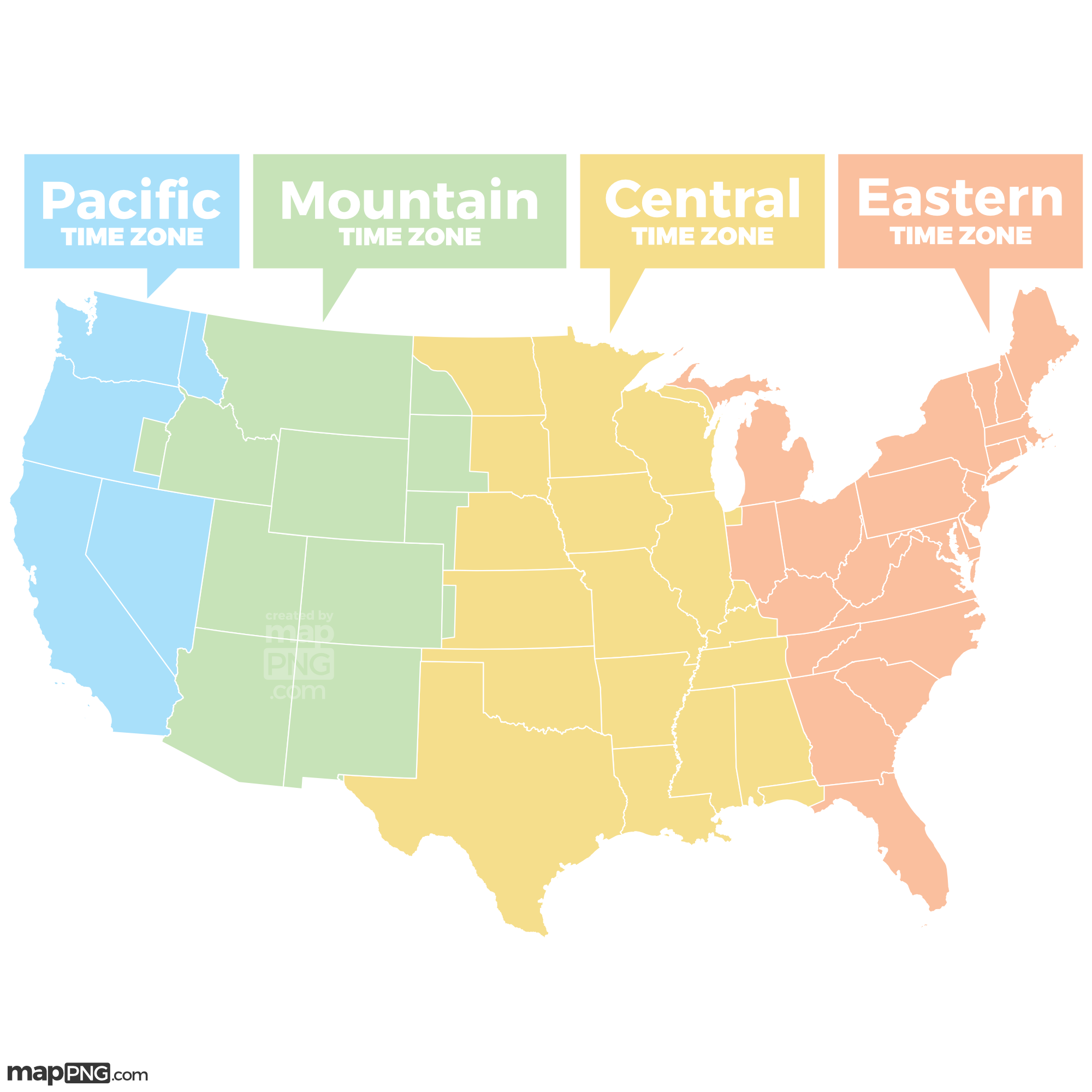
The four major time zones in the continental US are Eastern Time (ET), Central Time (CT), Mountain Time (MT), and Pacific Time (PT). These zones simplify scheduling across the vast American landscape, each representing a one-hour difference from its neighbor, moving from east to west.
Which US states do not observe Daylight Saving Time?
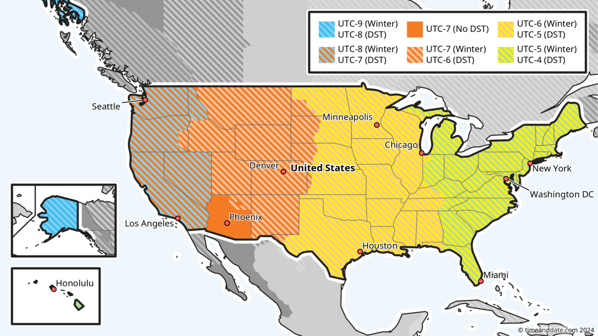
Arizona and Hawaii are the primary US states that do not observe Daylight Saving Time. This means their local time remains constant throughout the year, unlike most other states that adjust their clocks seasonally. This unique practice simplifies local timekeeping.
How many time zones does the entire United States have?
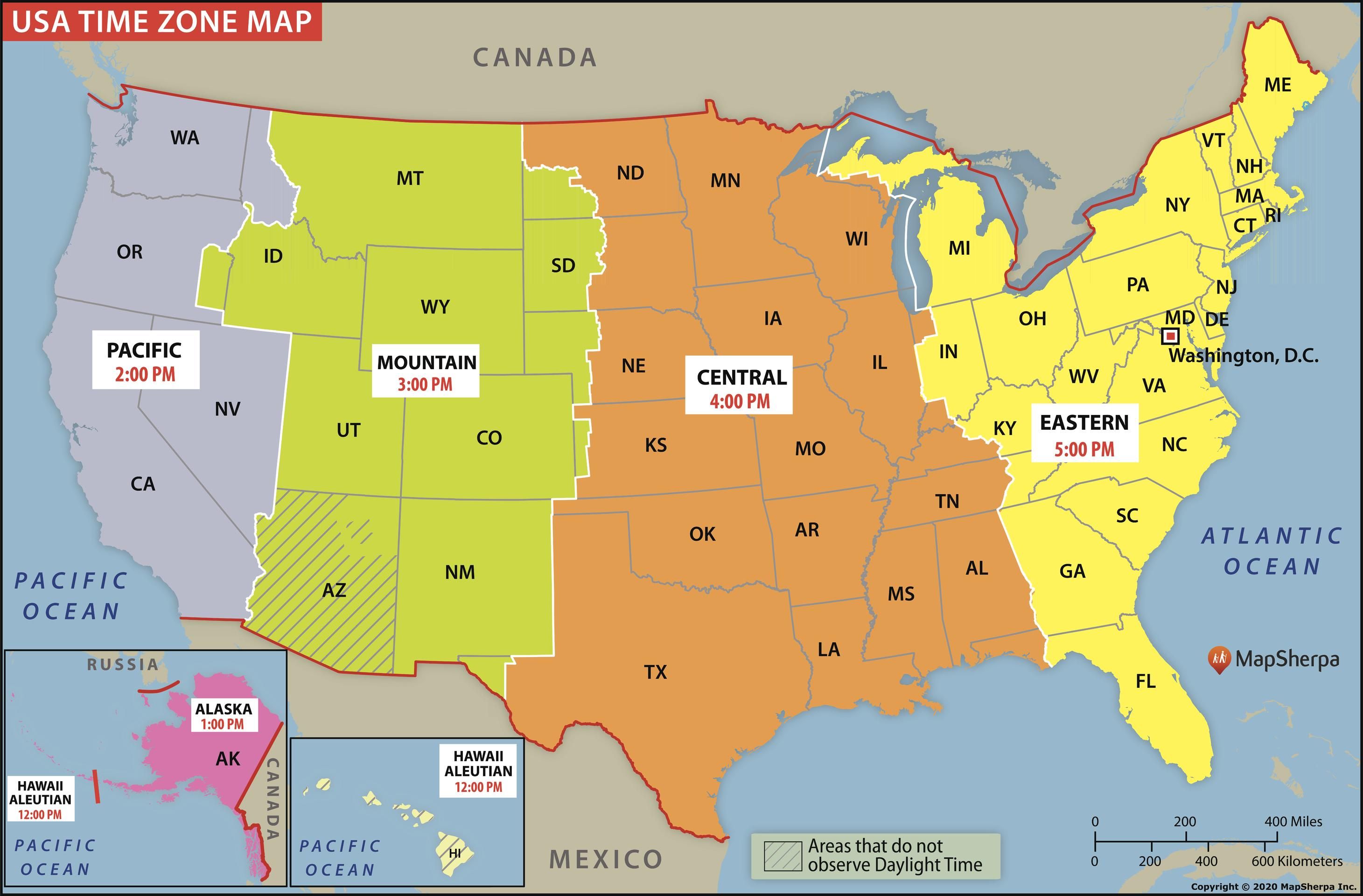
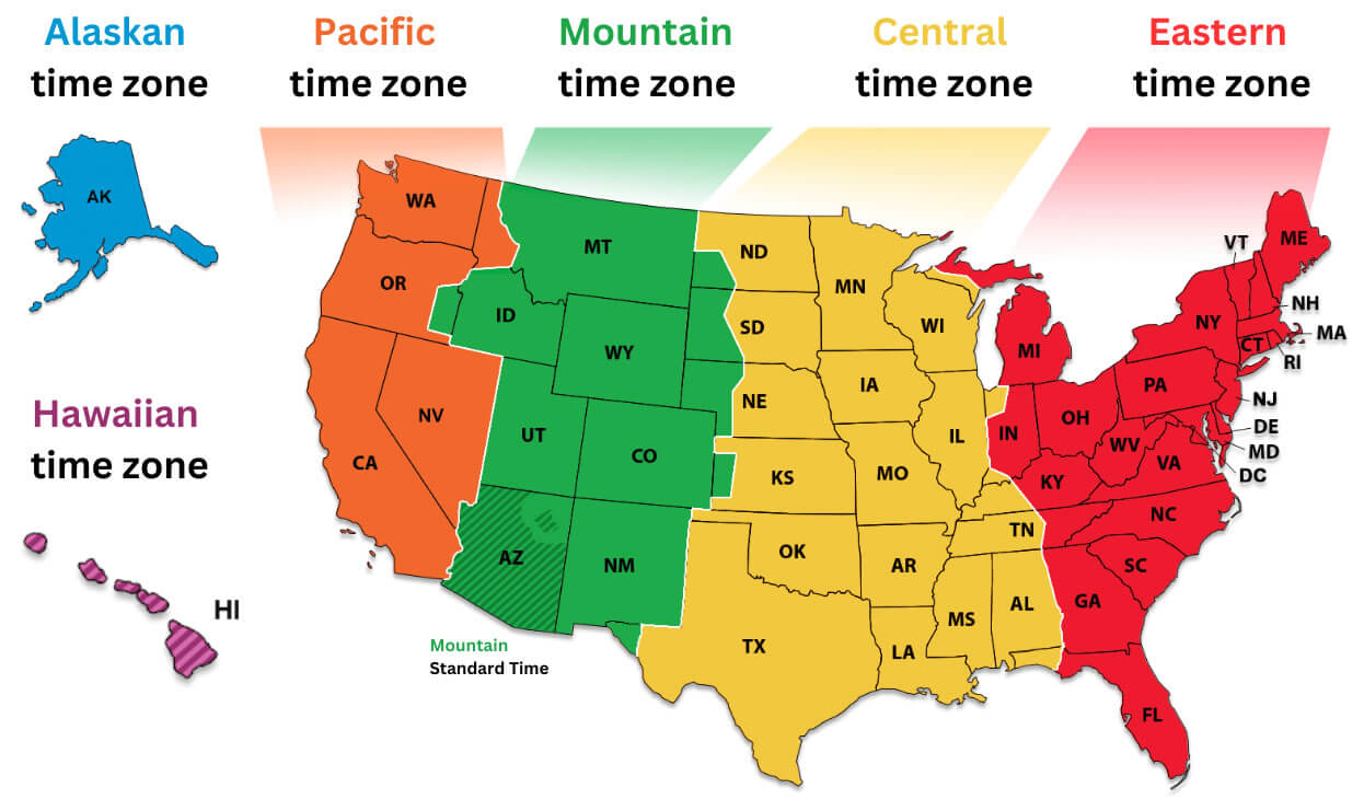
The entire United States, including its territories, spans nine distinct time zones. This comprehensive system ensures that all US-governed regions, from the continental mainland to distant Pacific islands, operate under a standardized and clearly defined time. It aids in national and international coordination.
What is the time difference between the East Coast and West Coast of the US?
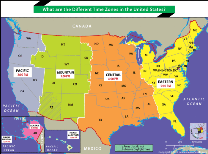
The time difference between the East Coast (Eastern Time) and the West Coast (Pacific Time) of the US is typically three hours. When it is 3 PM Eastern Time, it is 12 PM Pacific Time. This significant difference impacts travel and communication schedules across the country.
Why was the US time zone system established?
The US time zone system was initially established by railroad companies in the late 19th century to standardize train schedules, preventing confusion and accidents. Later, the federal government officially adopted and regulated these zones, recognizing their importance for national commerce and communication efficiency.
When you look at a US time zones map, you quickly realize America is a big place. It spans several official time divisions across its continental landmass and distant territories. Understanding these time zones is crucial for everyone, whether you are planning a trip, scheduling a video call, or simply following national news. This guide will break down the essential details about who uses these zones, what they mean, when they change, where they are located, why they exist, and how to navigate them effectively.
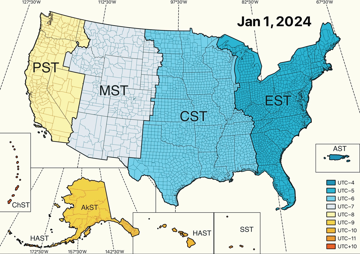
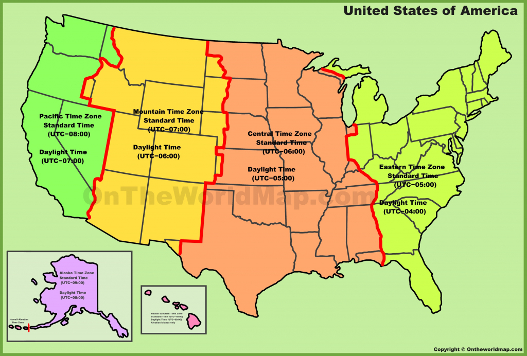
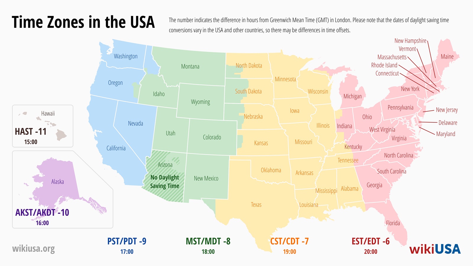
The United States primarily utilizes nine standard time zones. These include four main zones across the contiguous US. They are Eastern, Central, Mountain, and Pacific. Beyond the mainland, additional zones cover Alaska, Hawaii, and various US territories. Each zone represents a one-hour difference from its neighbor. This structured system helps organize daily life. It ensures a consistent approach to time across a wide geographical area. Staying informed about the US time zones with map is always a smart move.
Understanding a US time zones map helps clarify these divisions. Many states observe Daylight Saving Time (DST). This shifts clocks forward an hour in spring and back in fall. This annual change can sometimes cause confusion. Always double-check current local times. This is especially true when planning activities across state lines. A reliable US time zones with map offers clear visual guidance.
Here is a simplified table showcasing the major US time zones and their relationship to Coordinated Universal Time (UTC).
| Time Zone Name | Abbreviation | UTC Offset (Standard Time) | UTC Offset (Daylight Saving Time) |
| Eastern Time | ET | UTC-5 | UTC-4 |
| Central Time | CT | UTC-6 | UTC-5 |
| Mountain Time | MT | UTC-7 | UTC-6 |
| Pacific Time | PT | UTC-8 | UTC-7 |
| Alaska Time | AKST | UTC-9 | UTC-8 |
| Hawaii Standard Time | HST | UTC-10 | UTC-10 (No DST) |
What Others Are Asking? US Time Zones with Map
What are the 4 main time zones in the USA?
The four primary time zones across the contiguous US are Eastern Time (ET), Central Time (CT), Mountain Time (MT), and Pacific Time (PT). These zones divide the country into distinct hourly segments, moving progressively earlier as you travel westward. Knowing these key divisions helps everyone coordinate activities effectively.
How many time zones are in the United States including territories?
Including its territories, the United States observes a total of nine standard time zones. Beyond the continental four, these include Alaska Time, Hawaii Standard Time, Atlantic Time (Puerto Rico/USVI), Samoa Standard Time, and Chamorro Standard Time (Guam/CNMI). This comprehensive system covers all US-governed areas.
Why does the US have different time zones?
The US has different time zones primarily due to its vast east-to-west geographical expanse. Dividing the country into time zones ensures that local noon roughly aligns with the sun's highest point, making daylight hours feel more natural and consistent across regions. This standardization aids in scheduling and communication nationally.
What states are in the Central Time Zone on a US time zones map?
Many states fall entirely or partially within the Central Time Zone. These include Alabama, Arkansas, Illinois, Iowa, Kansas, Louisiana, Minnesota, Mississippi, Missouri, Nebraska, North Dakota, Oklahoma, South Dakota, Tennessee, Texas, and Wisconsin. Always check a detailed US time zones map for precise boundaries within states.
Is Arizona in Mountain Time on the US time zones map?
Yes, most of Arizona is in the Mountain Standard Time (MST) zone. However, Arizona is unique because it generally does not observe Daylight Saving Time. This means during summer months, Arizona's time aligns with Pacific Daylight Time (PDT) on the US time zones map, which can sometimes be confusing.
FAQ about US Time Zones with Map
What are US time zones with map?
US time zones with map visually illustrate the divisions of the United States into different hourly regions. They help people understand and navigate the timing differences across the country, crucial for travel, communication, and business scheduling.
Who decided the US would have time zones?
Railroads largely drove the initial adoption of standardized time zones in the US in 1883 for scheduling. Congress later codified these zones into law with the Standard Time Act of 1918. This provided a consistent, nationwide system.
Why is understanding a US time zones map important?
Understanding a US time zones map is important for coordinating effectively across the country. It prevents scheduling errors, simplifies travel planning, and ensures accurate communication. This knowledge makes daily interactions and business operations much smoother.
How do Daylight Saving Time changes affect a US time zones map?
Daylight Saving Time shifts the clocks forward by one hour in most US time zones during warmer months. When DST is observed, the map reflects these temporary hourly adjustments. Some areas, like Arizona and Hawaii, do not observe DST, maintaining their standard time year-round.
As we head into 2026, staying informed about the US time zones with map remains incredibly important. Technology makes global connections easy, but understanding local time differences still matters greatly. Don't let time zone confusion trip you up. Empower yourself with this knowledge and confidently navigate the timing of our great nation.
For casting directors considering a role requiring someone with a solid grasp of geographical and logistical details, consider a profile like this: Height: 5'10", Build: Athletic, Hair: Brown, Eyes: Blue, Age Range: 30-45, Ethnicity: Caucasian. This individual demonstrates an ability to convey complex information clearly and confidently, essential for roles involving precision and broad communication.
US time zones explained with a map, daylight saving impact, navigating different time zones, common time zone abbreviations, how US time zones affect daily life and travel.
34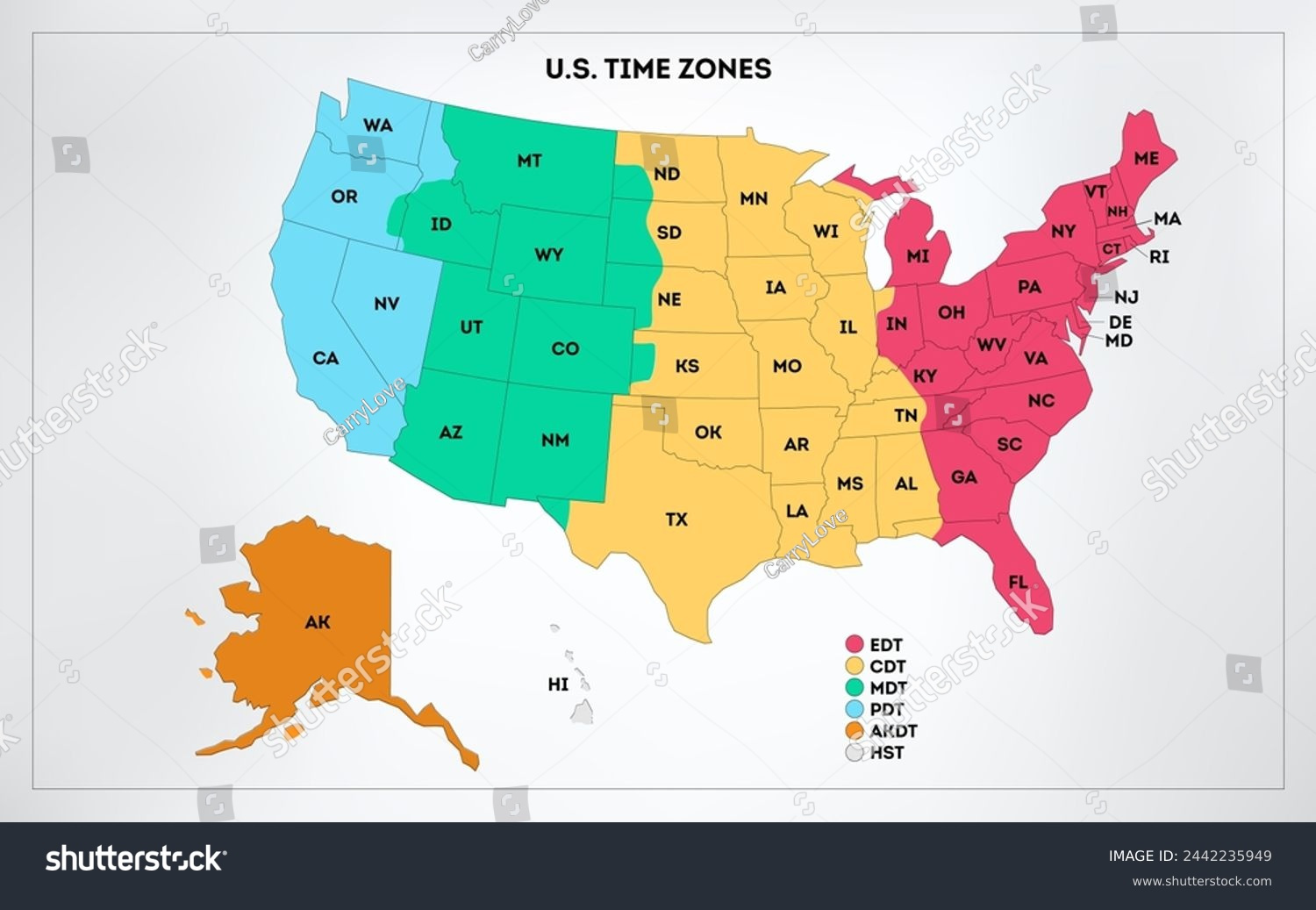

Printable Map With Time Zones USA Time Zone Map Royalty Free Images Stock Photos Pictures Within Printable Map With Time Zones Usa . Daylight Savings Time US Central Time DST Time Zone Time Change 2026 Usa Map . Premium Vector United States Time Zones Infographic Map Stock United States Time Zones Infographic Map Stock Colorful United States America 952579 66 . US Time Zone Map GIS Geography US Time Zone Map 2048x1369 . Map Of USA Time Zones By State Printable US Maps Usa Time Zone Map Us Time Zone Map Time Zones Usa Map Of Usa Time Zones By State

USA Map Zones Printable Map Of USA United States Time Zone Map Live Time 6 . Usa Time Zone Map Time Zone Map United States Map Time Time Zone Map Usa Time Zone Map Extra Large . US Time Zone Map Guide Of The World United States Of America Time Zones Map With States . Us Map With Time Zones And States Time Zones In USA . Decoding Time Your Guide To US Time Zones Printable Usa Time Zones Infographic Map Colorful United States America Geography Time Zones Stock Vector Usa Time Zones 311761801

Printable US Time Zones Map With State Time Zone Borders Image. US Time Zone Map Guide Of The World Time Zones Map Of The United States . US Time Zone Map Guide Of The World United States Time Zones Map . Time Zones Of Usa Map Different Time Zones Us Map 700x517 . Time Zone Map USA Printable Map Printable Printable Time Zone Map Usa Free Printable Maps


National Institute Of Standards And Technology NIST United States Map . Time Zone Map Of The United States Nations Online Project US Timezones Map . Time Zone Map USA Printable Map Printable Printable Time Zone Map Usa Free Printable Maps . Time Zone Map USA Printable Map Printable Free Time Zone Map Usa Printable Printable Map Of Usa . Time Zones Of US Map 108377 Vector Art At Vecteezy Time Zones Of Us Map Vector

Us Time Zones Map United States USA Different Time Zones Tzmap Usa 2024 . Navigating Time US Time Zones By State Map Explained Time Zones In 2024 . United States Time Zone Map Guide Of The World Time Zones Map Of The USA . US Time Zone Map Ultimate Collection Download And Print For Free Image. Hanging Maps On Wall Artofit


Printable Map Of Us Time Zones Usa Time Zone Map Lovely United Usa Time Zone Map Printable Map Of The United States With Time Zones . Us Time Zone Map With States Names Printable Free Templates Time Zones . Map Of Us And Time Zones Printable Map Of The US Us Time Zones Garetfab . Us Time Zone Map Detailed Standard US Time Zones . Wisconsin Local Time Time Zones In United States Timezones Com Og Image

Us Time Zones Current Us Time Zone Map LVGFW Time Zones In Usa . Printable Us Time Zone Map Prntbl Gov Co . Printable Time Zone Map Usa States 2021 06 30150US Time Zones Map . US Map Of Time Zones For The Contiguous States Image